
Buck Mountain — Aug. 2, 2026
I had originally planned to do an off-trail trip with my friend Paulina this weekend, but unexpected circumstances (i.e. food poisoning) led to this becoming a solo sunrise summit adventure. My goal was Buck Mountain, which offers a panoramic view of the Palisades in a way no other peak in the area can compete with. The “standard” route of this rarely-climbed peak starts with a bushwhack up from the South Fork Big Pine Creek trail. Not wanting to do that in the dark, I opted instead to suffer up scree and chossy talus from Big Pine Lakes.
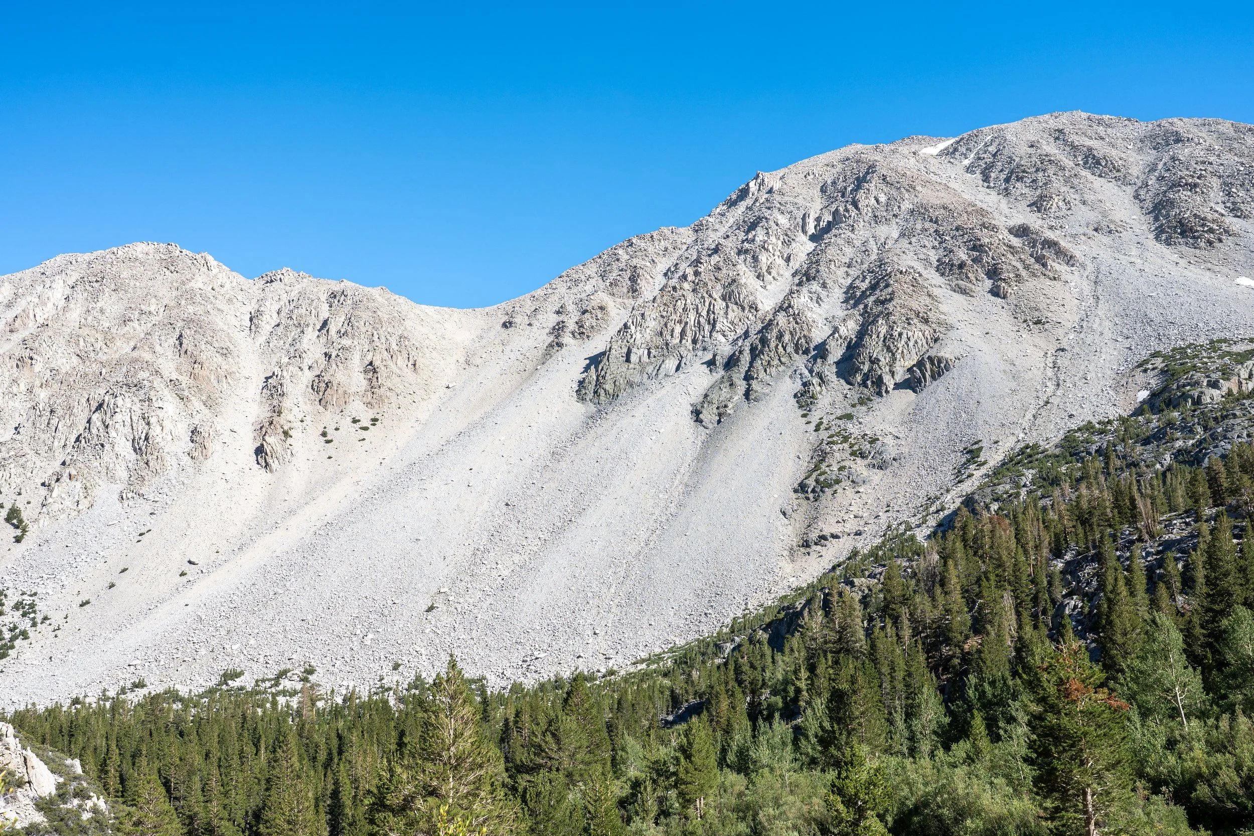
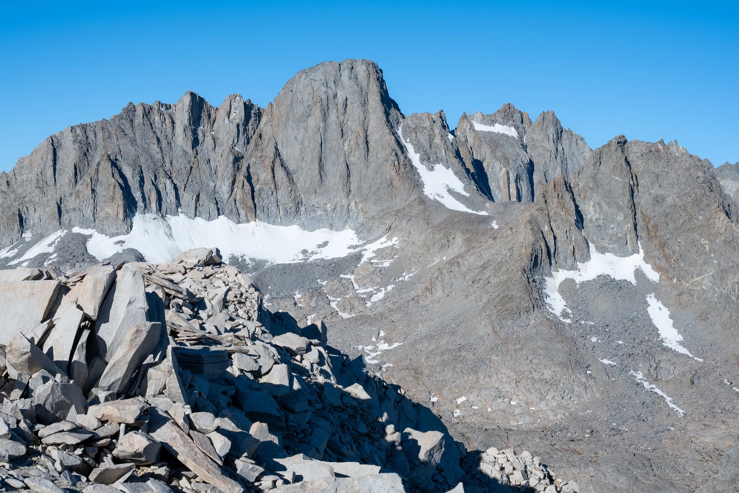
Northern slopes of Buck Mountain. The true summit is the unassuming pile of talus just above the highest lingering snowfield in the upper right corner. My ascent and descent gully was beneath the low point on the ridge line slightly left of center.
For sunrise summits, I typically leave myself extra time in case unexpected obstacles present themselves. Getting to the summit from the Big Pine Lakes trailhead involves about 5200 ft of elevation gain and 7 miles. I figured an 11:30 PM start would be more than enough with just my day pack on. In reality, this hike was much harder than I had expected and I summited about ten minutes after sunrise proper. I planned to a ascend a scree gully which started from below First Lake and rose to 11,300 ft where it meets with the approach from the South Fork. Accessing this gully proved to be a bit annoying. The most direct approach would have probably been to leave the Big Pine Lake trail around 9700 ft and cross the North Fork of Big Pine Creek. This looked like it would entail some bushwhacking and also involve a ford of the creek which was flowing quite fast. Instead, I followed the use trail to the Second Lake dam, ascended to roughly 10,400 ft on talus, and then traversed over to the desired gully. This ended up being far worse than the direct approach. The traverse crossed multiple steep talus gullies and the talus itself was extremely chossy. This added about an hour to my moving time and is the main reason I ended up missing sunrise.
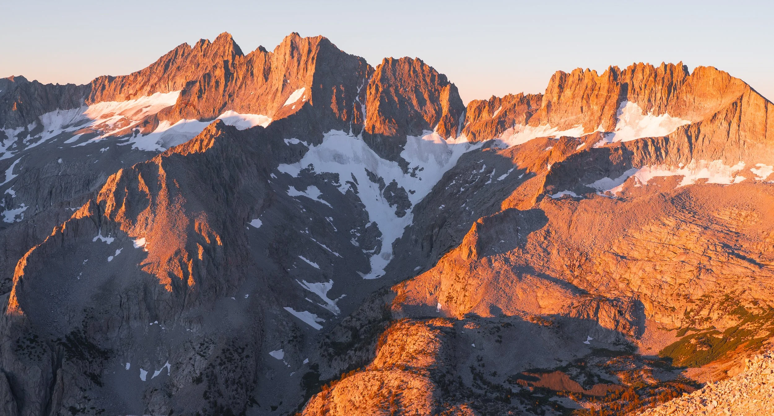
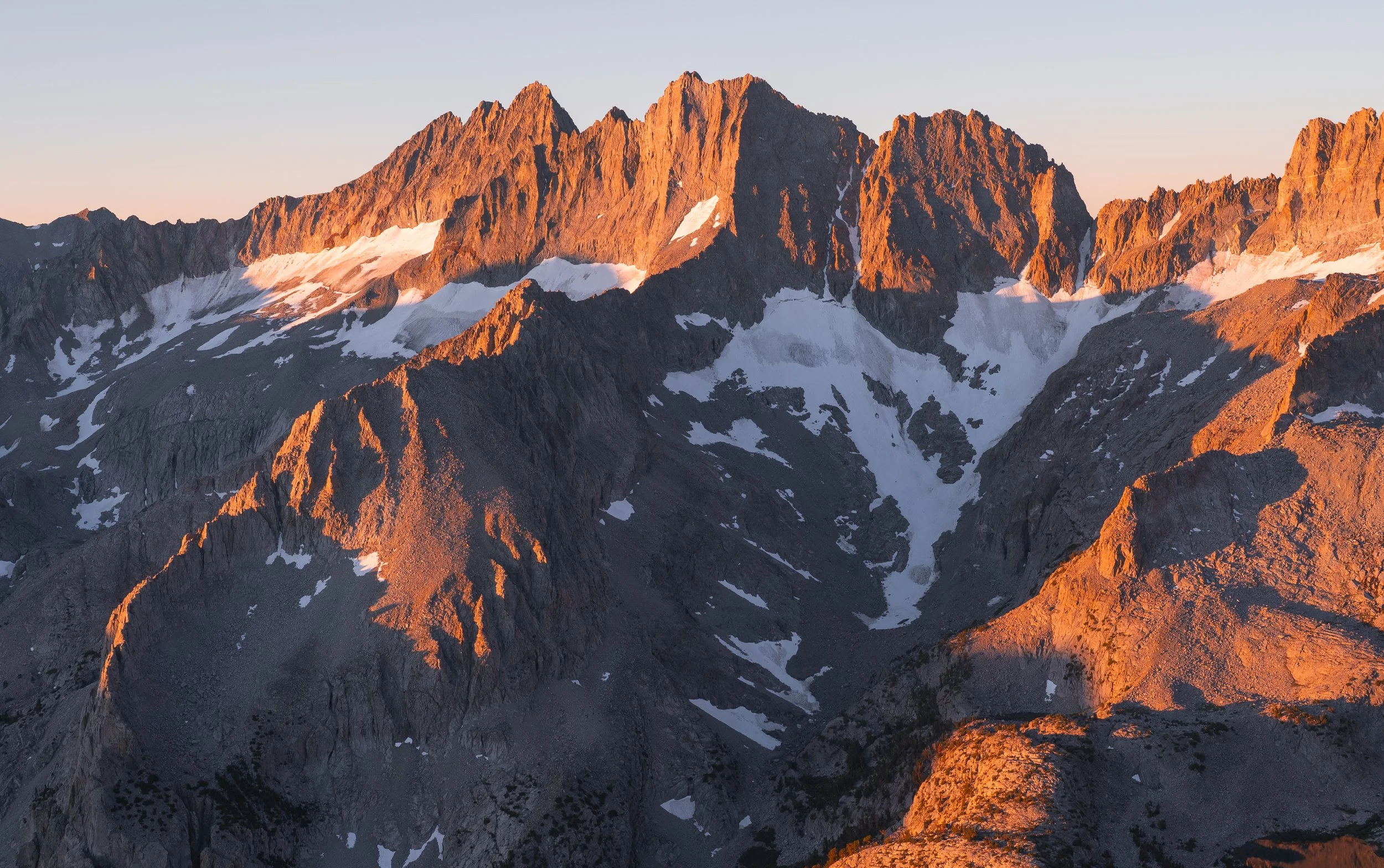
The tail end of sunrise over the southern Palisades.
Once I met up with the gully I intended to ascend, I found myself with two less-than-ideal options. The first was scree, the deepest I’d ever seen and the kind that sends you three steps backwards for every step forward. The second was a more balanced approach consisting of rock hopping across the scree in an unpleasant game of “the scree is lava.” I opted for the latter. Neither option was technically difficult but both were absolutely exhausting. Even the talus embedded in the scree was liable to move when it looked like it absolutely shouldn’t. Once at the top of the gully, the terrain improved a bit in the sense that the talus became more frequent. On the other hand, there were some patches of hard dirt masquerading as scree on this part.
I roughly followed the ridgeline to the summit. The summit ridge consisted of multiple tiny subpeaks which were all one connected mass of somewhat loose talus. I bypassed these subpeaks on the south side, which ended up being very slow. On my descent I followed the much more mellow scree slopes on the north side. I arrived at the true summit about ten minutes after sunrise and was only able to photograph some shots of the southern Palisades in decent lighting. A proper view of Mt. Sill and the northern part of the subrange was partly obscured by low satellite summits of Buck Mountain to the south. I suspect a better view could be had by traversing all the way to the edge of the summit ridge, but I was running on fumes and didn’t bother.
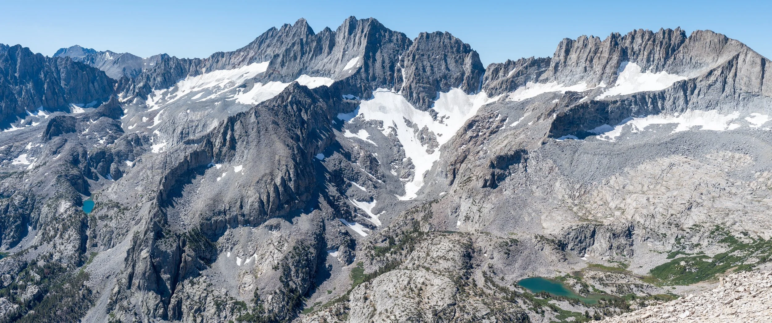
Summit panorama of the southern Palisades starting from The Thumb and panning to Mt. Sill.
Despite how much work it was to get to the summit and how gross I felt from not adequately eating and drinking fluids on the ascent, the vibes were immaculate. I napped for a couple of hours, snacked and ate a proper breakfast (shoutout Stowaway Gourmet miso salmon okayu), and took some more photos. This trip got me thinking more about my motivations for scrambling and climbing. I have several friends who claim that climbing is more about the process and less about the views. For me, it’s the opposite. I’ll gladly suffer up crummy terrain if the promised views are good. A high quality scramble route conversely doesn’t really mean anything to me without the views to accompany it.
I didn’t leave the summit until slightly after noon. This time, I stuck to the north side of the summit which avoided tedious talus hopping and stayed near the center of the ridgeline dropping back down to the gully. The scree here was a real boon for once! The gully descent took all of 20 minutes and the deep scree meant that any boulders that came loose quickly sank so deeply that they lost their momentum and didn’t pose any hazard. I descended until about 10,000 ft where I began side hilling with the intention of rejoining the use trail between First and Second Lakes without going high up on the talus like on my ascent. The side hilling was very tedious and extremely chossy. The talus varied from large and unstable to small and ball bearing-like, all of which had me hoping I wouldn’t roll an ankle or worse. At least at this elevation, the slope wasn’t as steep as my ascent traverse at several hundred feet higher. Once in the trees. I paralleled the outlet of First Lake while skirting cliff bands as necessary. This part was slow-going and blisteringly hot in the midst of a summer heat wave.
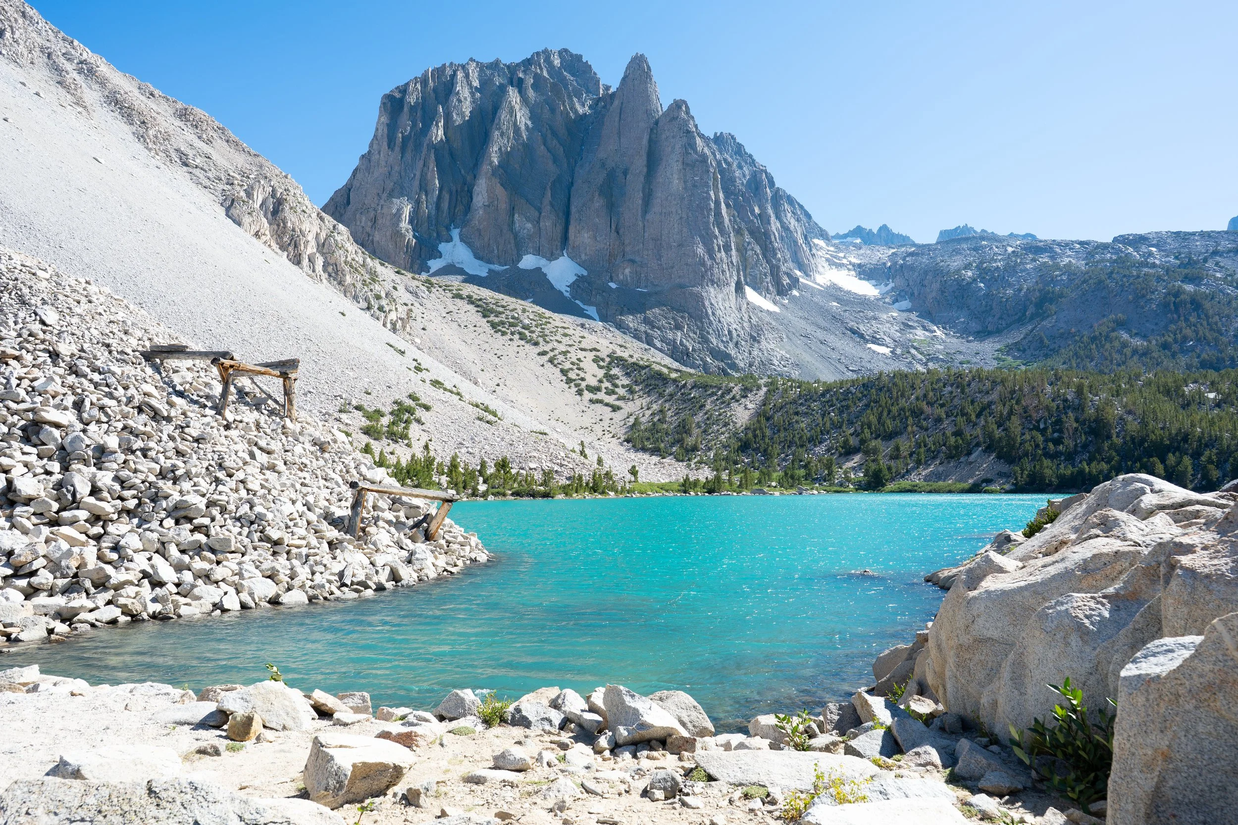
Relaxing at Big Pine Lakes after a big day.
If I were to do this again, I would probably skirt the forested area above the Second Lake dam by contouring it on the talus, then descend a couple hundred feet and traverse over to the scree gully at the 10,000 ft mark or lower. Another option would be to ascend the gully situated almost directly above where the Second Lake dam use trail ends. This gully didn’t look that steep but my main concerns were that it would be all scree and potential rockfall due to the narrow and steep walls. This approach also avoids talus side hilling lower down and is a straight shot to the summit. If I’m ever tempted to return from the Big Pine Lakes side, I would consider giving this alternative route a try.
I joined the throngs of day hikers headed back down to the trailhead. Due to how many breaks and naps I took, most of the trail was already in shade, a welcome respite from the heat. This ended up being one the longer day hikes I’ve done. I didn’t end up getting home until the next morning due to the necessity of multiple naps on the drive home. Definitely a trip that has to marinate for awhile before I consider doing it again…
—Justin
